Detailed Soil Water Balance and Groundwater Recharge (Model GWN-BW)
The soil is the central compartment governing the water availability at a given location as well as controlling the water balance of a catchment. The soil's capabilities to absorb and store water manages the partitioning of rain water to evaporation and the different runoff generation components resulting in differing mobile runoff paths. Filter and decomposition processes purify the percolating water. Hence there are manifold questions to soil water balance in the fields of agriculture, water supply or flood protection for example.
In a water management point of view the areal groundwater recharge has a predominant weight in the water balance factors. The water supply in far reaching parts of e.g. Germany relys on renewable natural groundwater resources. Therefore possible changes in groundwater recharge rate would not be without consequences for the safety and sustainability of the resources.
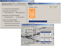
The model platform GWN-BW has been developed as a tool for the authorities of the Federal States and therefore its functionlities have been adopted to the needs given. To describe soil water processes, physically based as well as conceptional approaches have been implemented, with a special focus on parametrisation of area-wide input data. Model Wizards allow for a flexible control of model configuration and result output. The simulation is carried out in a high time resolution of days and area detailed for single locations as well as state-wide evaluations.
References
In the recent years GWN-BW has been used for state wide as well as regional applications concerning soil water balance and groundwater recharge in the Federal States of Baden-Württemberg, Bavaria, Rhineland Palatinate, cross-border in the Rine Valley and last but not least in Hesse. In the cooperative project of KLIWA simulations were carried out using climate change scenario data WETTREG resulting from the simulations ECHAM5/A1B and ECHAM4/B2 and the results have been extensively analysed for different future time slices.
There are further applications for example for municipalities or private sector dealing with nitrate percolation in water conservation areas or to provide a harmonised upper boundary condition for groundwater modelling.


