Rainfall-Run-off Modelling, Water Balance Models (Model WASIM-ETH)
GHCTriBil2_02.pdf
PDF-Document [208.5 KB]
To simulate the components of water balance or run-off from small basins to nationwide catchments, we basically use the deterministic area detailed hydrological model
WASIM-ETH. It can be applied to consider soil water balance and the water balance components - precipitation, evaporation and runoff -
as well as runoff components for nearly every spatial resolution and independently of the time scale of input data.
The close contact with the model developer and the ongoing further development are evident for expert working even in complex terrain conditions.
There can be a variety of questions addressed by the model, such as:
- transpiration of plants and surfaces
- soil water balance, soil drought, irrigation need
- run-off in surface waters, low flow and flood issues
- runoff components (precipitation, evaporation, infiltration, water storage, runoff) and water-related mass transport (isotopes, water soluble substances)
- influence of land use and climate change
- sustainable adaptation strategies (land use change, reservoir management)
Dimensioning of design floods is mostly carried out with simpler software tools like the toolbox for flood analysis and calculation (IWG).
References
- Report International WASIM User Conference (Presentation)
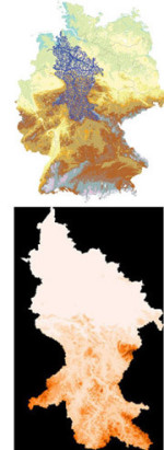
- Waterbalance Modelling at the Wesergebiet (GHCTriBil2_02.pdf)
- Flood protection Eichstetten (German version: Hochwasserschutz Eichstetten - Hydrologische Untersuchungen und Flussgebietsmodell Dorfbach Eichstetten [2002, 2008])
- Design of flood control basin (German version: Bemessung der Hochwasserrückhaltebecken HRB Breike und HRB Laire auf der Gemarkung Bötzingen [2004])
- Rainfall-runoff modelling (German Version: GEP Freiburg - NA-Modellierung Teil Entwässerungsgebiete Batzenberg Nord, Mooswald [2003, in cooperation with IHF])


